Table of Contents
Land surveys are conducted in various ways, with the aim of obtaining information about the boundaries, characteristics, and suitability of land for construction or development.
Depending on your project, you may need different types of surveys.
The primary categories are ALTA/NSPS, construction, boundary, topographic, and subdivision surveys. However, I am studying this type of information.
Land surveys are essential for property ownership, development, and legal clarity. Whether you are buying a new home, planning construction, or resolving a boundary dispute, the type of Boundary mapping you need depends on your specific requirements.
In this comprehensive guide, we will explore different types of Boundary mapping, their purposes, and how to determine which one suits your needs.

What is a Land Survey?
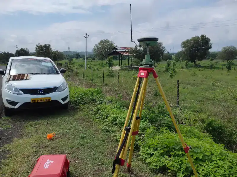
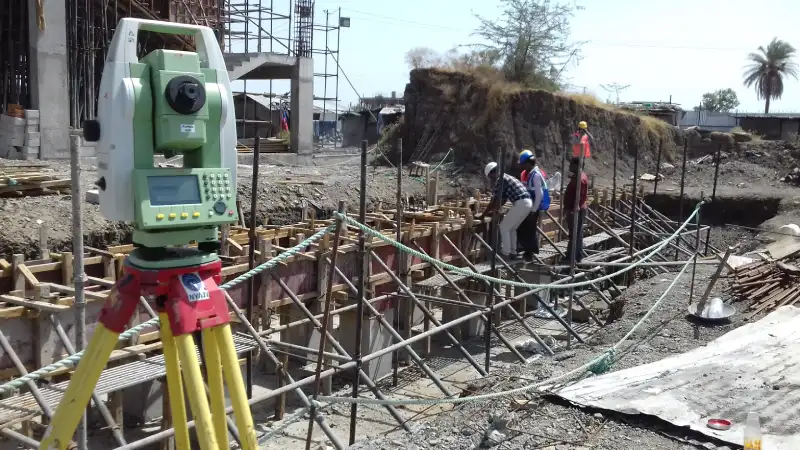
A land survey is a detailed measurement and mapping of a property’s boundaries, structures, and features. It ensures accuracy in determining property lines, resolving disputes, or complying with legal requirements. To do surveys, professional land surveyors utilize specialized equipment such as GPS, theodolites, and total stations.
Land surveys date back centuries, with early civilizations using rudimentary tools to define territories. Today, modern technology has made surveys highly accurate and efficient, ensuring better property management and dispute resolution.
Common Types of Land Surveys
Here are some of the most common types of Boundary mapping and when you might need them:
1. Boundary Survey
Purpose: To determine property lines and establish the legal boundaries of a parcel of land.
When to Use:
Buying or selling property.
Resolving boundary disputes.
Installing fences or walls.
Details: A boundary survey includes marking property corners and creating a map that shows the limits of the property. Surveyors may also place physical markers like stakes or pins to demarcate boundaries clearly.
2. Topographic Survey
Purpose: To map the physical features and elevation of a property.
When to Use:
Planning construction projects.
Designing drainage systems.
Environmental studies.
Details: This survey provides information about natural and man-made features like trees, hills, buildings, and utilities. Engineers and architects rely on topographic surveys to plan projects that integrate seamlessly with the terrain.
3.ALTA/NSPS Land Title Survey
Purpose: To meet the requirements of title insurance companies during real estate transactions.
When to Use:
Commercial property transactions.
High-value property deals.
Details: An ALTA survey includes detailed property information like easements, encroachments, and zoning. It is one of the most comprehensive types of surveys and often requires collaboration between surveyors and legal professionals.
4. Subdivision Survey
To separate a piece of land into smaller lots is the goal.
When to Use:
Developing residential or commercial subdivisions.
Selling portions of a large property.
Details: Subdivision surveys include planning and layout of roads, utilities, and lots. These surveys are crucial for obtaining local government approvals for development projects.

5. Construction Survey
Purpose: To guide construction projects and ensure structures are built in the right locations.
When to Use:
Building homes, roads, or bridges.
Aligning structures with plans.
Details: Construction surveys involve staking out points for foundations, columns, and other structural elements. They also ensure compliance with building standards and design parameters.
6. Floodplain Survey
Purpose: To determine if a property is in a flood zone.
When to Use:
Purchasing flood insurance.
Developing property near water bodies.
Details: In order to evaluate flood risks, this survey incorporates elevation data. Properties in flood zones may require additional permits or construction modifications.
7. Boundary Line Adjustment Survey
Purpose: To modify existing property boundaries.
When to Use:
Resolving boundary issues with neighbors.
Adjusting land for development purposes.
Details: This survey requires agreements between neighboring property owners and official approval. It helps redefine boundaries without altering the total land area.
“Check out our guide on land surveying step by step.”
1. How to Conduct a Topographic Survey Step by Step: A Comprehensive Guide in 2025
2.“How to Read a Land Survey Map: Complete Guide in 6 Simple Steps”
3. How to Find Property Lines for Fencing: 10 Easy Ways
8 . As-Built Survey
Purpose: To document completed construction projects.
When to Use:
Verifying compliance with design plans.
Closing construction contracts.
Details: As-built surveys show the location of all structures, utilities, and improvements on a property. They are often required before issuing occupancy permits.
9. Lot Survey
Purpose: To verify property dimensions and boundaries for smaller plots of land.
When to Use:
Residential property purchases.
Small-scale property improvements.
Details: Similar to a boundary survey but focused on individual lots. These surveys are useful for homeowners making additions or improvements.
10. Environmental Survey
Purpose: To assess a property’s environmental conditions.
When to Use:
Identifying potential contamination.
Complying with environmental regulations.
Details: Environmental surveys evaluate soil, water, and air quality, often as part of due diligence in property transactions.
11. Mortgage Survey
Purpose: To satisfy the requirements of a lender during property transactions.
When to Use:
Securing a mortgage.
Buying or refinancing property.
Details: This survey confirms property boundaries and ensures no encroachments or zoning violations exist that could affect the lender’s investment.
12. Geodetic Survey
Purpose: To measure large land areas for scientific or infrastructural purposes.
When to Use:
National or regional mapping projects.
Infrastructure development like highways or railways.
Details: Geodetic surveys account for the curvature of the Earth, making them ideal for large-scale mapping and precise measurements.
How to Determine the Type of Survey You Need
Your particular situation will determine which Land measurement survey is best for you. The following are some typical situations and the suggested survey formats:
Scenario 1: Buying or Selling Property
Recommended Surveys:
Boundary Survey
ALTA/NSPS Land Title Survey (for commercial deals)
Scenario 2: Planning Construction Projects
Recommended Surveys:
Construction Survey
Scenario 3: Resolving Boundary Disputes
Recommended Surveys:
Boundary Survey
Boundary Line Adjustment Survey
Scenario 4: Developing Land
Recommended Surveys:
Subdivision Survey
Topographic Survey
Construction Survey
Scenario 5: Assessing Flood Risks
Recommended Surveys:
Floodplain Survey
Elevation Certificate Survey
FAQs About Land Surveys
How much does a land survey cost?
The size, location, and type of survey needed all affect how much a Land measurement costs. On average, boundary surveys cost between $300 and $700, while ALTA surveys can range from $1,500 to $3,000 or more.
Can I skip a land survey when buying a property?
Skipping a Boundary mapping can lead to boundary disputes, legal issues, and unexpected costs. It is highly recommended to conduct a survey before purchasing a property.
How long does a land survey take?
The length of time depends on the type of survey and the size of the property. Simple surveys like boundary surveys can take 1-3 days, while more complex surveys like ALTA surveys may take several weeks.
Do I need a survey for fencing my property?
Yes, a boundary survey is essential to ensure the fence is installed within your property lines.
Who conducts land surveys?
Licensed land surveyors, who are trained professionals with expertise in measurement and mapping, perform land surveys.
Can a land survey reveal encroachments?
Yes, surveys like boundary and ALTA surveys can identify encroachments, such as structures extending onto your property.
Are land surveys legally binding?
Land surveys are legally recognized documents that can be used in court to resolve disputes or establish property rights.
What distinguishes an ALTA survey from a border survey?
A boundary survey focuses on defining property lines, while an ALTA survey includes additional details like easements, zoning, and encroachments, typically required for commercial transactions.
How often should I update my land survey?
You should update your survey whenever you make significant changes to your property or suspect boundary disputes. Regular updates help maintain legal clarity.
Can a surveyor help with zoning compliance?
Yes, surveyors often provide insights into zoning regulations and help ensure your property meets local requirements.
Why Hire a Professional Land Surveyor?
Accuracy, legal compliance, and peace of mind are guaranteed when you work with a qualified land surveyor. Surveyors have the expertise and tools to provide detailed reports that meet local regulations and industry standards. Investing in a professional survey can save time and money in the long run by preventing disputes and errors.
Conclusion
Understanding the type of land survey you need is crucial for any property-related project. Whether you are buying land, constructing a building, or resolving a dispute, selecting the right survey ensures accuracy and compliance. Always consult a licensed surveyor to discuss your needs and obtain a reliable survey. With this guide, you are now better equipped to make informed decisions about land surveys.
- Measurement Units for Length: A Complete Guide for Everyone - February 14, 2025
- LiDAR and Drones in Surveying: The Ultimate 2025 Guide - February 4, 2025
- “Ultimate RTK GPS 2025 How-to Guide: Step-by-Step Instructions” - January 26, 2025

