“Land Survey Hub Blog – Expert Insights & Guides”
Introduction
Land surveying is not just a profession; it is a responsibility. I am Er. Datta Gore has been working in this field for the past 10 years, continuously learning and adapting to new technologies and challenges. My journey has been filled with obstacles, but each one has been an opportunity to grow.
The Beginning and Challenges
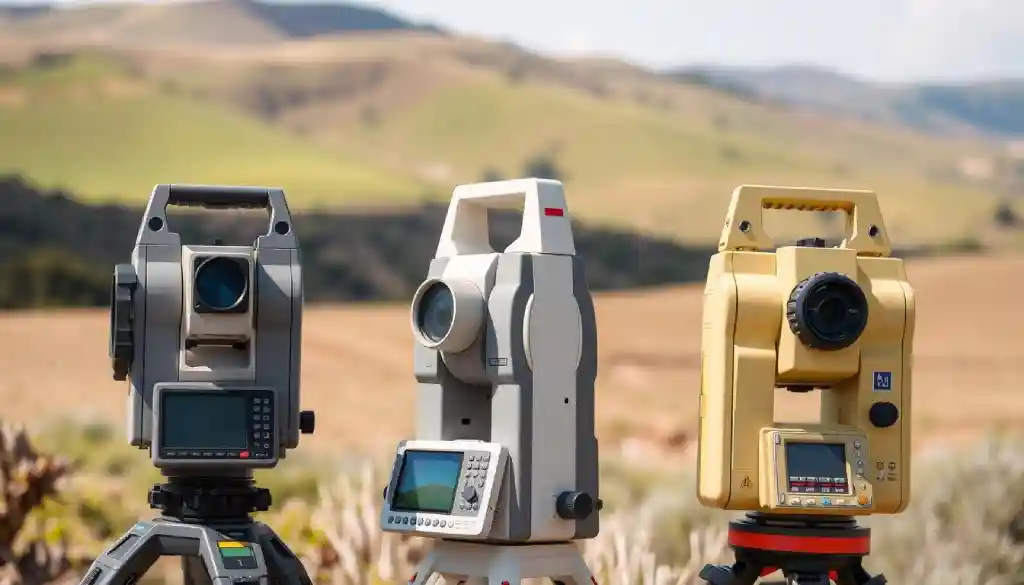
When I first stepped into the world of land surveying, using simple tools like measuring tapes and theodolites felt like a huge task. Understanding and adapting to modern instruments like GPS and total stations was not easy, but I was determined to learn.
Working in rural areas, I realized that land disputes, outdated maps, and the concerns of local farmers were common challenges. Helping people understand legal aspects and providing them with accurate survey services became an essential part of my work.
Technology and Progress
Today, the land surveying industry has undergone a technological revolution. Drone surveying, LiDAR technology, and GIS software have made measurements more precise and efficient. I have made it a priority to stay updated with these advancements and incorporate them into my work.
Client Trust – My True Earning
Once, a client told me, “Our future depends on the accuracy of your survey.” That statement stayed with me. For me, land surveying is not just about measuring land—it is about giving people reliable data that can shape their decisions. Every project I undertake is done with honesty and precision.
A Message for the New Generation
Land surveying is not just about drawing maps; it is a blend of science, research, and service to society. If you love learning new things, adapting to technology, and interacting with people, this field can be a great career choice.
Final Thoughts
Over the past 10 years, I have learned that land surveying is more than just a job—it is a responsibility, a challenge, and a journey of growth. My goal is to keep learning and to guide the next generation in this profession.
For You:
Are you interested in learning more about land surveying? Feel free to visit LandSurveyHub.com I’d be happy to help!
Step-by-Step Total Station Setup Guide for Beginners
If you’re a beginner in the world of land surveying, learning how to set up a total station is one of the most critical skills to master. A total station is an essential instrument that combines electronic distance measurement (EDM) and angular measurement to provide accurate data for mapping, construction, and land assessment projects. In…
Resolving Boundary Disputes: Expert Advice
Key TakeawaysCommon Types of Property Line ConflictsPrimary Causes of Boundary DisagreementsBenefits of MediationTimeline ExpectationsEffective Communication Techniques Documentation During Negotiations Setting Realistic Expectations What are the common types of property line conflicts?What are the primary causes of boundary disagreements?How can boundary disputes impact property rights and values?What are some signs that I’m facing a property boundary…
Measurement Units for Length: A Complete Guide for Everyone
Introduction Measurement Units for Length are essential in our everyday lives, whether you’re a student, an engineer, or someone working in construction. In this article, you will learn about different length measurement units, how they work, and why they matter. We will also discuss how these units apply to various real-life situations like land surveying…
Mastering Topographic Surveys in 2025: A Complete Guide to Accurate Mapping
Key TakeawaysDefinition and Basic PrinciplesEvolution of Survey MethodsCurrent Industry StandardsEnvironmental Obstacles Technical Issues ResolutionHow have survey methods evolved over time?What is the essential equipment needed for professional land surveying?How are drones and LiDAR technology being used in terrain modeling?What are the key steps in conducting a topographic survey?How can survey data be effectively processed and…
LiDAR and Drones in Surveying: The Ultimate 2025 Guide
Introduction LiDAR and drones in surveying are transforming how surveys are conducted, providing more accurate results in less time. These technologies have revolutionized traditional surveying methods, offering precision and efficiency. Imagine a world where land surveying no longer requires days of manual labor under the scorching sun. Thanks to LiDAR (Light Detection and Ranging) technology…
How to Find Property Lines for Fencing: 10 Easy Ways
Why Knowing Property Lines is Important1. Refer to Your Estate Deed2. Check the Plat Map3. Look for Boundary Markers4. Use a GPS Land Survey App5. Visit the County Assessor’s Office6. Hire a Licensed Land Surveyor7. Check for Existing Fences and Structures8. Use a Metal Detector for Hidden Survey Pins9. Utilize Online GIS Mapping Tools10. Talk…
- Measurement Units for Length: A Complete Guide for Everyone - February 14, 2025
- LiDAR and Drones in Surveying: The Ultimate 2025 Guide - February 4, 2025
- “Ultimate RTK GPS 2025 How-to Guide: Step-by-Step Instructions” - January 26, 2025


